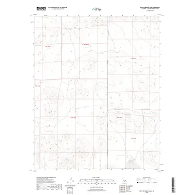
2018 Map of West of Nelson Lake
USGS Topo · Published 2018About this map
Mojave Desert terrain dominates this high-desert landscape in San Bernardino County, where the topography is defined by dry washes and arid basins. A central feature of the southeastern portion of the map is Goldstone Lake, a dry lake bed typical of the region's interior drainage patterns. Modern infrastructure is limited to the north-south corridor of Randsburg Rd, which cuts through the desert flats to provide access to this isolated area. The map illustrates the complex Public Land Survey System intersections in the region, showing where townships T28S, T29S, T15N, and T16N converge. This junction reflects the historical surveying challenges of the California desert, where different baseline systems meet.
Find a feature on this map
9 named features on this map. Tap any name to fly to it.
Don’t see what you’re looking for? This feature index may not catch every label — zoom into the map to look around manually.
Map Details
Editions of this 2018 West of Nelson Lake Map
This is the sole edition of this map. No revisions or reprints were ever made.
Other maps of this area

1915 · Searles Lake
USGS Topo · 1:250,000

1933 · Avawatz Mountains
USGS Topo · 1:250,000

1947 · Trona
USGS Topo · 1:250,000

1948 · Trona
USGS Topo · 1:250,000

1948 · Quail Mountains
USGS Topo · 1:62,500

1948 · Goldstone Lake
USGS Topo · 1:62,500

1950 · Wingate Pass
USGS Topo · 1:62,500

1951 · Goldstone Lake
USGS Topo · 1:62,500

1951 · Wingate Pass
USGS Topo · 1:62,500

1951 · Quail Mountains
USGS Topo · 1:62,500