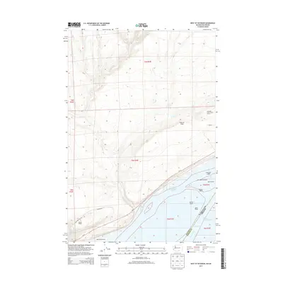
2013 Map of West of Paterson
USGS Topo · Published 2013About this map
The Columbia River corridor dominates this 2013 survey of the border between Washington and Oregon. The landscape is defined by the expansive waters of Lake Umatilla, where numerous landforms such as Telegraph Island, Blalock Islands, and Whitcomb Island punctuate the river channel. North of the water, the terrain rises toward Paterson Ridge and Canoe Ridge, marked by the seasonal drainage of Glade Cr. The presence of the Columbia Crest Winery Airport and the Sandpiper Farms Leveling Road indicates the specialized agricultural and industrial uses of this arid riverbank region. Transportation is anchored by Wa-14, which follows the northern shoreline, providing a link between the river's various channels, including the North Channel Columbia River and South Channel Columbia River.
Find a feature on this map
28 named features on this map. Tap any name to fly to it.
Don’t see what you’re looking for? This feature index may not catch every label — zoom into the map to look around manually.
Map Details
Editions of this 2013 West of Paterson Map
This is the sole edition of this map. No revisions or reprints were ever made.
Other maps of this area

1906 · Blalock Island
USGS Topo · 1:125,000

1908 · Blalock Island
USGS Topo · 1:125,000

1915 · Prosser
USGS Topo · 1:125,000

1917 · Prosser
USGS Topo · 1:125,000

1953 · Pendleton
USGS Topo · 1:250,000

1953 · Walla Walla
USGS Topo · 1:250,000

1956 · Pendleton
USGS Topo · 1:250,000

1958 · Walla Walla
USGS Topo · 1:250,000

1962 · Canoe Ridge
USGS Topo · 1:24,000

1962 · Blalock Island
USGS Topo · 1:24,000