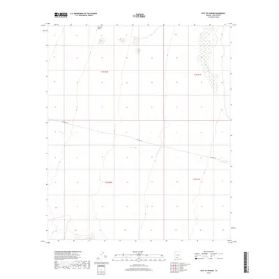
2018 Map of West of Pisinimo
USGS Topo · Published 2018About this map
Quijotoa Valley dominates this arid landscape in the Pisinemo District of Pima County, where the desert floor is defined by a sparse network of ephemeral drainages and a single primary transit route. The northern reaches of the map show the broad expanse of the valley, while the eastern edge is marked by the course of San Simon Wash. Running east-to-west through the center of the sheet, Indian Rte 28 provides the only significant modern infrastructure across the terrain. Hydrological patterns are further illustrated by the Gu Vo Wash, which meanders through the southern sections. This 2018 survey captures the region's topographical character through clear contouring, documenting the fundamental water courses and township boundaries like t15s r2w that organize this remote desert geography.
Find a feature on this map
8 named features on this map. Tap any name to fly to it.
Don’t see what you’re looking for? This feature index may not catch every label — zoom into the map to look around manually.
Map Details
Editions of this 2018 West of Pisinimo Map
This is the sole edition of this map. No revisions or reprints were ever made.
Other maps of this area

1953 · Ajo
USGS Topo · 1:250,000

1954 · Sonoyta
USGS Topo · 1:250,000

1957 · Ajo
USGS Topo · 1:250,000

1958 · Ajo
USGS Topo · 1:250,000

1962 · Ajo
USGS Topo · 1:250,000

1963 · Ajo
USGS Topo · 1:250,000

1963 · Kom Vo
USGS Topo · 1:62,500

1963 · Mt. Ajo
USGS Topo · 1:62,500

1963 · Pisinimo
USGS Topo · 1:62,500

1963 · Lukeville
USGS Topo · 1:250,000