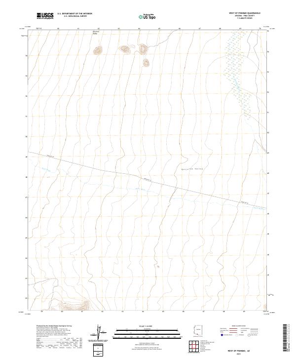
2021 Map of West of Pisinimo
USGS Topo · Published 2021About this map
Quijotoa Valley dominates this arid landscape within Pima County, where the desert floor is defined by a series of significant drainage systems. The northern reaches are marked by the branching network of San Simon Wash, while Gu Vo Wash cuts across the southern half of the quadrangle. Transport through this remote section of the Sonoran Desert is limited primarily to Indian Rte 28, which follows the natural contours of the valley floor. The map documents the vast, open character of the region, emphasizing the importance of these seasonal watercourses in shaping the local topography and historical access routes through the Arizona desert.
Find a feature on this map
8 named features on this map. Tap any name to fly to it.
Don’t see what you’re looking for? This feature index may not catch every label — zoom into the map to look around manually.
Map Details
Editions of this 2021 West of Pisinimo Map
This is the sole edition of this map. No revisions or reprints were ever made.
Other maps of this area

1953 · Ajo
USGS Topo · 1:250,000

1954 · Sonoyta
USGS Topo · 1:250,000

1957 · Ajo
USGS Topo · 1:250,000

1958 · Ajo
USGS Topo · 1:250,000

1962 · Ajo
USGS Topo · 1:250,000

1963 · Ajo
USGS Topo · 1:250,000

1963 · Kom Vo
USGS Topo · 1:62,500

1963 · Mt. Ajo
USGS Topo · 1:62,500

1963 · Pisinimo
USGS Topo · 1:62,500

1963 · Lukeville
USGS Topo · 1:250,000