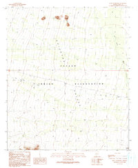
1990 Map of West of Pisinimo
USGS Topo · Published 1990About this map
The Quijotoa Valley dominates this arid landscape within the Papago Indian Reservation, as documented by a 1988 field check. The terrain is defined by a series of alluvial fans and drainage channels, most notably the Gu Vo Wash and San Simon Wash. Man-made modifications to the natural water flow are evident through several Check Dams and an individual Check Dam strategically placed to manage seasonal runoff. In the southeastern corner of the quadrangle, the settlement of Schuk Cowlik serves as a primary point of human habitation, connected to the surrounding desert by unimproved roads and 4wd tracks. This provisional survey captures the balance between traditional desert life and federal land management in the Sonoran Desert at the close of the 20th century.
Find a feature on this map
9 named features on this map. Tap any name to fly to it.
Don’t see what you’re looking for? This feature index may not catch every label — zoom into the map to look around manually.
Map Details
Editions of this 1990 West of Pisinimo Map
This is the sole edition of this map. No revisions or reprints were ever made.
Other maps of this area

1953 · Ajo
USGS Topo · 1:250,000

1954 · Sonoyta
USGS Topo · 1:250,000

1957 · Ajo
USGS Topo · 1:250,000

1958 · Ajo
USGS Topo · 1:250,000

1962 · Ajo
USGS Topo · 1:250,000

1963 · Ajo
USGS Topo · 1:250,000

1963 · Kom Vo
USGS Topo · 1:62,500

1963 · Mt. Ajo
USGS Topo · 1:62,500

1963 · Pisinimo
USGS Topo · 1:62,500

1963 · Lukeville
USGS Topo · 1:250,000