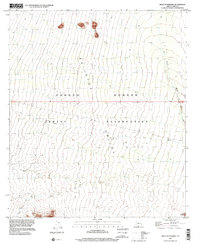
1996 Map of West of Pisinimo
USGS Topo · Published 2001About this map
The Quijotoa Valley dominates this landscape within the Tohono O'odham Indian Reservation, showing a vast system of desert drainages. Topography compiled in the 1960s was updated with 1990s planimetry to illustrate the subtle shifts in the arid terrain before the turn of the millennium. The seasonal hydrology of the region is defined by the San Simon Wash and the Gu Vo Wash, which channel water through the alluvial fans of the valley floor. These washes represent critical landmarks in a region where water flow dictates both the natural environment and historical land use patterns. The map provides a clear look at the township and range lines, including the boundary between T 15 S and T 16 S, which helps orient researchers to the specific surveyed sections of this part of Pima County.
Find a feature on this map
5 named features on this map. Tap any name to fly to it.
Don’t see what you’re looking for? This feature index may not catch every label — zoom into the map to look around manually.
Map Details
Editions of this 1996 West of Pisinimo Map
This is the sole edition of this map. No revisions or reprints were ever made.
Other maps of this area

1953 · Ajo
USGS Topo · 1:250,000

1954 · Sonoyta
USGS Topo · 1:250,000

1957 · Ajo
USGS Topo · 1:250,000

1958 · Ajo
USGS Topo · 1:250,000

1962 · Ajo
USGS Topo · 1:250,000

1963 · Ajo
USGS Topo · 1:250,000

1963 · Kom Vo
USGS Topo · 1:62,500

1963 · Mt. Ajo
USGS Topo · 1:62,500

1963 · Pisinimo
USGS Topo · 1:62,500

1963 · Lukeville
USGS Topo · 1:250,000