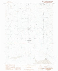
1988 Map of West of Quartzite Mountain
USGS Topo · Published 1988About this map
Nellis Air Force Range (Restricted Area) dominates this high-desert landscape in Nye County, showing the specialized infrastructure of a late-20th-century military testing ground. The map details a strictly controlled environment where massive geological features like Gold Flat and multiple unnamed basins marked simply as Depression are interspersed with observation points including a Tower 40 Ft and Tower 30 Ft. The transition from defense territory to public land management is marked by the Nevada Wild Horse Management Area, which borders the restricted zone to the east. The presence of Jackpot Reservoir and the solitary Pass Road suggest the limited but essential modifications made to this arid terrain for both military operations and resource management in the 1980s.
Find a feature on this map
9 named features on this map. Tap any name to fly to it.
Don’t see what you’re looking for? This feature index may not catch every label — zoom into the map to look around manually.
Map Details
Editions of this 1988 West of Quartzite Mountain Map
This is the sole edition of this map. No revisions or reprints were ever made.
Other maps of this area

1908 · Kawich
USGS Topo · 1:250,000

1942 · Tolicha Peak
USGS Topo · 1:125,000

1942 · Cactus Range
USGS Topo · 1:125,000

1942 · Reveille Peak
USGS Topo · 1:125,000

1942 · Wheelbarrow Peak
USGS Topo · 1:125,000

1952 · Mellan
USGS Topo · 1:62,500

1952 · Quartzite Mtn
USGS Topo · 1:62,500

1952 · Silent Canyon
USGS Topo · 1:62,500
1952 · Black Mtn
USGS Topo · 1:62,500

1954 · Goldfield
USGS Topo · 1:250,000