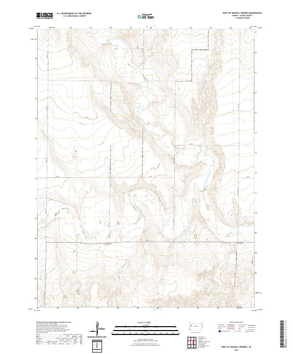
2022 Map of West of Russell Springs
USGS Topo · Published 2022About this map
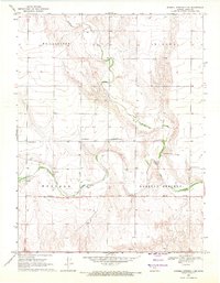
The N Fork Smoky Hill River and the main branch of the Smoky Hill River converge in this section of Logan County, shaping a landscape of deep drainage channels and high plains plateaus. The topography is defined by the erosion of the river system, which carves through the central Kansas terrain between the established ranges of T12S and T13S. A sparse network of roads follows the section lines of the Public Land Survey System, including Co RD 160 and Co RD 220, while specific local routes such as Osage, Rawhide, and Topeka provide access to the interior rangelands. The map reveals the characteristic spatial organization of the American West, where the natural wandering paths of the water contrast with the rigid, square-mile grid of the township system.
Find a feature on this map
17 named features on this map. Tap any name to fly to it.
Don’t see what you’re looking for? This feature index may not catch every label — zoom into the map to look around manually.
Map Details
Editions of this 2022 West of Russell Springs Map
This is the sole edition of this map. No revisions or reprints were ever made.
Other maps of this area

1954 · Goodland
USGS Topo · 1:250,000

1955 · Scott City
USGS Topo · 1:250,000

1956 · Goodland
USGS Topo · 1:250,000

1957 · Goodland
USGS Topo · 1:250,000

1958 · Scott City
USGS Topo · 1:250,000
1969 · Russell Springs 2 NW
USGS Topo · 1:24,000
1969 · Mc Allaster SE
USGS Topo · 1:24,000
1969 · Russell Springs 2 SW
USGS Topo · 1:24,000
1969 · Russell Springs 2 NE
USGS Topo · 1:24,000
1969 · Russell Springs 2 SE
USGS Topo · 1:24,000