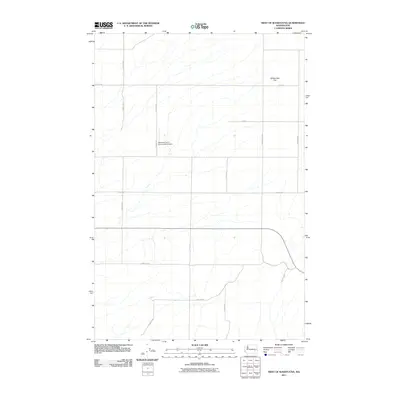
2011 Map of West of Washtucna
USGS Topo · Published 2011About this map
Rattlesnake Flat dominates the landscape of this high plateau region in Adams County, where agriculture and large-scale farming define the layout of the land. The grid of service roads, including S Dewald Rd and S Bauer Rd, reveals the systematic division of wheat fields and ranch lands characteristic of eastern Washington. A notable center of local operations is the Baumann Farm Incorporated Airport, a private airstrip that signifies the importance of aerial logistics in managing these expansive properties. Moving south toward the coulees, the terrain is marked by routes such as E Hampton Rd and E Hatton Rd, which follow the natural contours of the drainage patterns. This map serves as a detailed record of the intersection between private enterprise and the geography of the inland northwest.
Find a feature on this map
15 named features on this map. Tap any name to fly to it.
Don’t see what you’re looking for? This feature index may not catch every label — zoom into the map to look around manually.
Map Details
Editions of this 2011 West of Washtucna Map
This is the sole edition of this map. No revisions or reprints were ever made.
Other maps of this area

1916 · Connell
USGS Topo · 1:125,000

1918 · Connell
USGS Topo · 1:125,000

1923 · Washtucna
USGS Topo · 1:62,500

1925 · Washtucna
USGS Topo · 1:62,500

1948 · Ayer
USGS Topo · 1:62,500

1950 · Haas
USGS Topo · 1:62,500

1953 · Walla Walla
USGS Topo · 1:250,000

1958 · Walla Walla
USGS Topo · 1:250,000

1970 · Lind SE
USGS Topo · 1:24,000
1970 · Lind
USGS Topo · 1:24,000