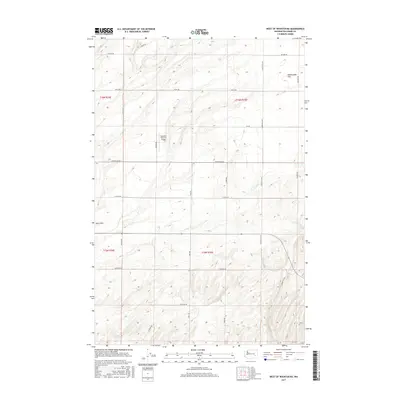
2017 Map of West of Washtucna
USGS Topo · Published 2017About this map
Baumann Farm Inc Airport serves as a lone aviation marker in this agricultural landscape of Adams County, where section lines and farm-to-market roads define the terrain. The map captures the transitional topography of eastern Washington, moving from the open expanse of Rattlesnake Flat in the northeast to the undulating forms of the Sand Hills in the west. A network of arterial roads, including S Marcellus Rd and Dewald Rd, provides the backbone for the region's transport and land management. The presence of named thoroughfares like S Suko Rd and Cunningham Rd highlights the organized grid system typical of the interior Pacific Northwest, documenting the scale of modern land use in a region historically defined by its unique basaltic and sandy geology.
Find a feature on this map
22 named features on this map. Tap any name to fly to it.
Don’t see what you’re looking for? This feature index may not catch every label — zoom into the map to look around manually.
Map Details
Editions of this 2017 West of Washtucna Map
This is the sole edition of this map. No revisions or reprints were ever made.
Other maps of this area

1916 · Connell
USGS Topo · 1:125,000

1918 · Connell
USGS Topo · 1:125,000

1923 · Washtucna
USGS Topo · 1:62,500

1925 · Washtucna
USGS Topo · 1:62,500

1948 · Ayer
USGS Topo · 1:62,500

1950 · Haas
USGS Topo · 1:62,500

1953 · Walla Walla
USGS Topo · 1:250,000

1958 · Walla Walla
USGS Topo · 1:250,000

1970 · Lind SE
USGS Topo · 1:24,000
1970 · Lind
USGS Topo · 1:24,000