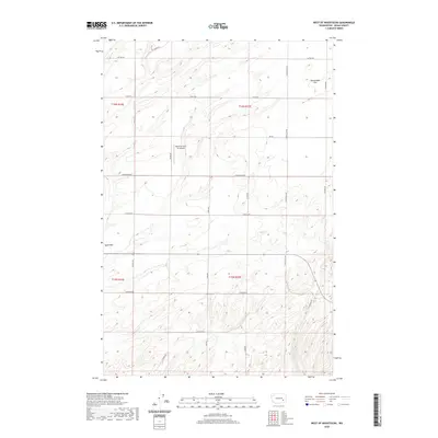
2020 Map of West of Washtucna
USGS Topo · Published 2020About this map
Rattlesnake Flat and the Sand Hills define the arid landscape of Adams County in this 2020 topographic survey. The region is marked by a grid of agricultural and access roads, including S Marcellus Rd, Bauer Rd, and Cunningham Rd, which reveal the section-line development of this rural corner of Washington. This topography shows the Channeled Scablands' unique drainage patterns and elevation changes across townships such as t16n r35e.
Find a feature on this map
22 named features on this map. Tap any name to fly to it.
Don’t see what you’re looking for? This feature index may not catch every label — zoom into the map to look around manually.
Map Details
Editions of this 2020 West of Washtucna Map
This is the sole edition of this map. No revisions or reprints were ever made.
Other maps of this area

1916 · Connell
USGS Topo · 1:125,000

1918 · Connell
USGS Topo · 1:125,000

1923 · Washtucna
USGS Topo · 1:62,500

1925 · Washtucna
USGS Topo · 1:62,500

1948 · Ayer
USGS Topo · 1:62,500

1950 · Haas
USGS Topo · 1:62,500

1953 · Walla Walla
USGS Topo · 1:250,000

1958 · Walla Walla
USGS Topo · 1:250,000

1970 · Lind SE
USGS Topo · 1:24,000
1970 · Lind
USGS Topo · 1:24,000