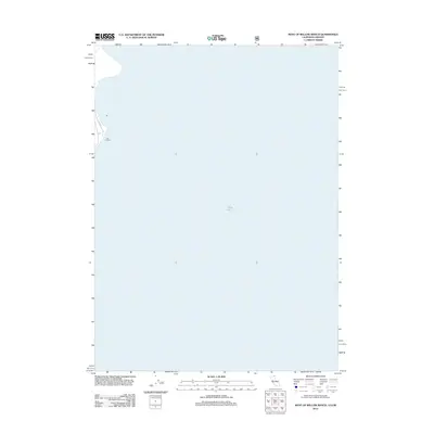
2012 Map of West of Willow Ranch
USGS Topo · Published 2012About this map
Goose Lake dominates this 2012 survey, its expansive waters stretching across the border of Oregon and California. The landscape shown here is largely aquatic, defined by the seasonal fluctuations of this large alkaline basin. On the northwestern shore, Log Landing serves as a small point of human activity, likely tied to the timber interests that have historically operated near the lake's edge. Access to this stretch of shoreline is provided by Co Rd 48, which follows the contours of the western bank. This topographic record preserves a snapshot of the lake's extent before recent drought cycles altered the shoreline of this high-desert water body.
Find a feature on this map
3 named features on this map. Tap any name to fly to it.
Don’t see what you’re looking for? This feature index may not catch every label — zoom into the map to look around manually.
Map Details
Editions of this 2012 West of Willow Ranch Map
This is the sole edition of this map. No revisions or reprints were ever made.
Other maps of this area

1886 · Alturas
USGS Topo · 1:250,000

1892 · Alturas
USGS Topo · 1:250,000

1954 · Alturas
USGS Topo · 1:250,000

1955 · Klamath Falls
USGS Topo · 1:250,000

1958 · Alturas
USGS Topo · 1:250,000

1958 · Klamath Falls
USGS Topo · 1:250,000

1962 · Alturas
USGS Topo · 1:250,000

1962 · Willow Ranch
USGS Topo · 1:62,500

1962 · South Mountain
USGS Topo · 1:62,500

1964 · Lakeview SW
USGS Topo · 1:24,000