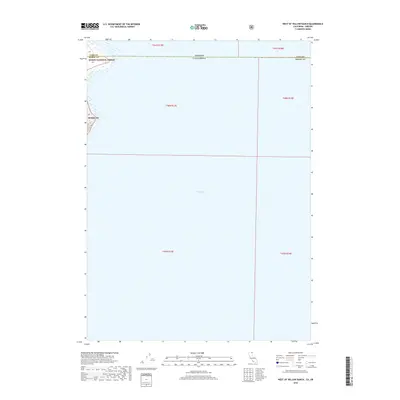
2018 Map of West of Willow Ranch
USGS Topo · Published 2018About this map
Goose Lake dominates this vast expanse, straddling the high-desert borderlands where Oregon and California meet. This 2018 survey depicts the massive, shallow basin that defines the landscape of Lake County and Modoc County. The map captures a section of the Oregon and California state line as it cuts directly across the water, illustrating the intersection of state jurisdictions and township boundaries like t41s r19e and t48n r13e. Along the western shoreline, the edge of the Modoc National Forest (also labeled as Modoc NF) is visible, where the terrain begins to transition away from the lakebed. A solitary road, Co Rd 48, provides the only significant terrestrial access point shown along the northwestern rim, highlighting the remote nature of this hydrologic feature.
Find a feature on this map
12 named features on this map. Tap any name to fly to it.
Don’t see what you’re looking for? This feature index may not catch every label — zoom into the map to look around manually.
Map Details
Editions of this 2018 West of Willow Ranch Map
This is the sole edition of this map. No revisions or reprints were ever made.
Other maps of this area

1886 · Alturas
USGS Topo · 1:250,000

1892 · Alturas
USGS Topo · 1:250,000

1954 · Alturas
USGS Topo · 1:250,000

1955 · Klamath Falls
USGS Topo · 1:250,000

1958 · Alturas
USGS Topo · 1:250,000

1958 · Klamath Falls
USGS Topo · 1:250,000

1962 · Alturas
USGS Topo · 1:250,000

1962 · Willow Ranch
USGS Topo · 1:62,500

1962 · South Mountain
USGS Topo · 1:62,500

1964 · Lakeview SW
USGS Topo · 1:24,000