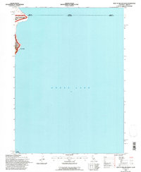
1993 Map of West of Willow Ranch
USGS Topo · Published 1997About this map
Goose Lake dominates this map, illustrating the expansive, shallow basin that straddles the Oregon California border. The western shoreline is traced by the boundary of the Modoc National Forest, where the terrain rises from the water's edge into the Ward area. This 1993 revision shows a landscape largely defined by the seasonal fluctuations of the lake, with the western shore providing a narrow corridor for land use between the water and the rising forest elevations.
Find a feature on this map
7 named features on this map. Tap any name to fly to it.
Don’t see what you’re looking for? This feature index may not catch every label — zoom into the map to look around manually.
Map Details
Editions of this 1993 West of Willow Ranch Map
This is the sole edition of this map. No revisions or reprints were ever made.
Other maps of this area

1886 · Alturas
USGS Topo · 1:250,000

1892 · Alturas
USGS Topo · 1:250,000

1954 · Alturas
USGS Topo · 1:250,000

1955 · Klamath Falls
USGS Topo · 1:250,000

1958 · Alturas
USGS Topo · 1:250,000

1958 · Klamath Falls
USGS Topo · 1:250,000

1962 · Alturas
USGS Topo · 1:250,000

1962 · Willow Ranch
USGS Topo · 1:62,500

1962 · South Mountain
USGS Topo · 1:62,500

1964 · Lakeview SW
USGS Topo · 1:24,000