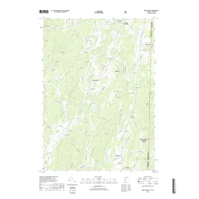
2018 Map of West Pawlet
USGS Topo · Published 2018About this map
The New York Vermont border cuts through this landscape, dividing the agricultural and wooded hills of Washington County from its neighbors to the east. The terrain is defined by a series of prominent elevations including Mt Tom, Grimes Hill, and Round Mtn, while the Indian River and Black Cr provide the primary drainage for the region. Small rural hamlets such as South Granville, North Hebron, and Slateville serve as focal points for a network of winding country roads like Co Rd 28 and Co Rd 31. Genealogy researchers will find significant value in the numerous family-named burial grounds scattered across the countryside, such as Tanner Cem, Moorehouse Cem, and Glasier Cem. To the southeast, the boundary of the Green Mountain National Forest marks a transition into more heavily timbered lands, illustrating the balance between highland farming and forest conservation in this borderland.
Find a feature on this map
94 named features on this map. Tap any name to fly to it.
Don’t see what you’re looking for? This feature index may not catch every label — zoom into the map to look around manually.
Map Details
Editions of this 2018 West Pawlet Map
This is the sole edition of this map. No revisions or reprints were ever made.
Other maps of this area

1893 · Fort Ann
USGS Topo · 1:62,500

1894 · Pawlet
USGS Topo · 1:62,500

1894 · Equinox
USGS Topo · 1:62,500

1895 · Cambridge
USGS Topo · 1:62,500

1895 · Fort Ann
USGS Topo · 1:62,500

1896 · Equinox
USGS Topo · 1:62,500

1897 · Pawlet
USGS Topo · 1:62,500

1898 · Cambridge
USGS Topo · 1:62,500

1898 · Fort Ann
USGS Topo · 1:62,500

1900 · Equinox
USGS Topo · 1:62,500