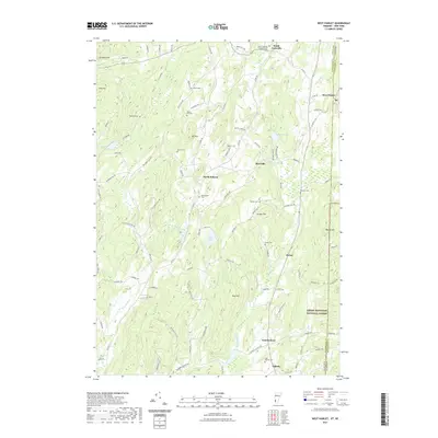
2021 Map of West Pawlet
USGS Topo · Published 2021About this map
The Indian River and Black Creek define the valley landscape of the New York and Vermont borderlands in this recent survey. Settlements such as South Granville, Slateville, and North Hebron are connected by a network of rural roads that weave through high points like Mt Tom and Grimes Hill. The map reveals a dense distribution of small family and community burial grounds, including Tanner Cem, Reynolds Cem, and Glasier Cem, which provide significant data for genealogical research along the state line. To the east, the boundary of the Green Mountain National Forest marks the beginning of protected wilderness near Porter. The presence of Quarry Rd near Round Mtn suggests the area's continued connection to the region's slate and stone heritage, even as agricultural and residential land uses predominate.
Find a feature on this map
107 named features on this map. Tap any name to fly to it.
Don’t see what you’re looking for? This feature index may not catch every label — zoom into the map to look around manually.
Map Details
Editions of this 2021 West Pawlet Map
This is the sole edition of this map. No revisions or reprints were ever made.
Other maps of this area

1893 · Fort Ann
USGS Topo · 1:62,500

1894 · Pawlet
USGS Topo · 1:62,500

1894 · Equinox
USGS Topo · 1:62,500

1895 · Cambridge
USGS Topo · 1:62,500

1895 · Fort Ann
USGS Topo · 1:62,500

1896 · Equinox
USGS Topo · 1:62,500

1897 · Pawlet
USGS Topo · 1:62,500

1898 · Cambridge
USGS Topo · 1:62,500

1898 · Fort Ann
USGS Topo · 1:62,500

1900 · Equinox
USGS Topo · 1:62,500