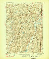
1946 Map of West Pawlet
USGS Topo · Published 1946About this map
South Granville and West Pawlet anchor this landscape along the New York-Vermont border, where the Delaware and Hudson railroad tracks parallel the Indian River. The map reveals a deeply settled rural interior marked by family names and small social centers, such as North Hebron and Chamberlain Mills. Numerous burial grounds including Reynolds Cem and Taylor Hill Cem suggest generations of local residency, while several educational sites like Sch No 4 and Braymer Sch are already noted as abandoned by the mid-1940s. The topography is defined by prominent heights like Mt Tom and Grimes Hill, which separate the drainage of Black Creek and Dead Creek. This survey provides a clear view of the transition from upland farmsteads to the concentrated rail-and-river economy along the state line.
Find a feature on this map
42 named features on this map. Tap any name to fly to it.
Don’t see what you’re looking for? This feature index may not catch every label — zoom into the map to look around manually.
Map Details
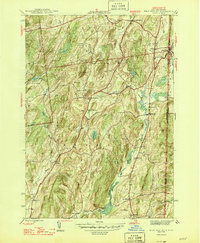
Editions of this 1946 West Pawlet Map
2 editions found
Other maps of this area

1893 · Fort Ann
USGS Topo · 1:62,500

1894 · Pawlet
USGS Topo · 1:62,500

1894 · Equinox
USGS Topo · 1:62,500

1895 · Cambridge
USGS Topo · 1:62,500

1895 · Fort Ann
USGS Topo · 1:62,500

1896 · Equinox
USGS Topo · 1:62,500

1897 · Pawlet
USGS Topo · 1:62,500

1898 · Cambridge
USGS Topo · 1:62,500

1898 · Fort Ann
USGS Topo · 1:62,500

1900 · Equinox
USGS Topo · 1:62,500