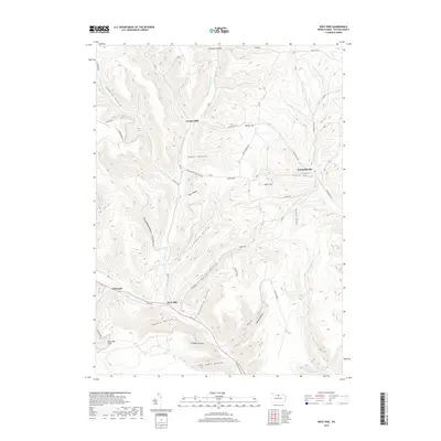
2019 Map of West Pike
USGS Topo · Published 2019About this map
Pine Creek carves a deep valley through this portion of Potter County, serving as the primary corridor for Rte 6 W and the small settlement of West Pike. The landscape is defined by a dense network of hollows and ridges, where family names like Loucks Mills and Sunderlinville mark historic clusters of activity along the water. To the west, the tiny hamlet of Telescope sits near the headwaters of Losey Run, while the surrounding uplands are dominated by steep terrain such as Meeker Ridge and Stiles Hill.
Find a feature on this map
68 named features on this map. Tap any name to fly to it.
Don’t see what you’re looking for? This feature index may not catch every label — zoom into the map to look around manually.
Map Details
Editions of this 2019 West Pike Map
This is the sole edition of this map. No revisions or reprints were ever made.
Other maps of this area

1899 · Gaines
USGS Topo · 1:62,500

1900 · Gaines
USGS Topo · 1:62,500

1932 · Genesee
USGS Topo · 1:62,500

1937 · Genesee
USGS Topo · 1:62,500

1947 · Conrad
USGS Topo · 1:62,500

1947 · Galeton
USGS Topo · 1:62,500

1947 · Cherry Springs
USGS Topo · 1:24,000

1947 · Galeton
USGS Topo · 1:24,000

1947 · Marshlands
USGS Topo · 1:24,000
1949 · Galeton
USGS Topo · 1:24,000
Featured Places
- Hector Township, PA
- Loucks Mills, Hector Township
- Sunderlinville, Hector Township
- Pike Township, PA
- Ulysses Township, PA