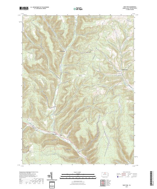
2023 Map of West Pike
USGS Topo · Published 2023About this map
West Pike sits at the confluence of several mountain drainages, serving as a focal point for this Potter County landscape where Pine Creek and the Genesee Forks meet. The map reveals a deeply etched topography of narrow valleys known locally as hollows, including Cushing Hollow and Hardscrabble Hollow, which define the region's physical character and settlement patterns. High points like Stiles Hill and Parker Hill overlook small communities such as Loucks Mills and Sunderlinville, while the West Pike Cem and Parker Hill Cem provide essential anchor points for local genealogical research. This contemporary view documents a quiet highland area where traditional forestry and mountain recreation intersect, evidenced by the extensive Susquehannock State Forest Snowmobile Trails Trl and the observation point at Rock Run Vista.
Find a feature on this map
58 named features on this map. Tap any name to fly to it.
Don’t see what you’re looking for? This feature index may not catch every label — zoom into the map to look around manually.
Map Details
Editions of this 2023 West Pike Map
This is the sole edition of this map. No revisions or reprints were ever made.
Other maps of this area

1899 · Gaines
USGS Topo · 1:62,500

1900 · Gaines
USGS Topo · 1:62,500

1932 · Genesee
USGS Topo · 1:62,500

1937 · Genesee
USGS Topo · 1:62,500

1947 · Conrad
USGS Topo · 1:62,500

1947 · Galeton
USGS Topo · 1:62,500

1947 · Cherry Springs
USGS Topo · 1:24,000

1947 · Galeton
USGS Topo · 1:24,000

1947 · Marshlands
USGS Topo · 1:24,000
1949 · Galeton
USGS Topo · 1:24,000
Featured Places
- Hector Township, PA
- Ulysses Township, PA
- Telescope, Ulysses Township
- Loucks Mills, Hector Township
- West Pike, Pike Township