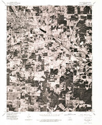
1976 Map of West Plains
USGS Topo · Published 1977About this map
West Plains is the focal point of this 1970s orthophotograph, captured by the U.S. Geological Survey using aerial photography from early 1976. The imagery reveals the concentrated urban grid of the town center transitioning into a patchwork of agricultural clearings and dense Ozark woodland. This specific format—an orthophotograph—serves as a bridge between traditional topographic data and raw aerial perspective, offering a clear view of land use patterns, property boundaries, and the road network as it existed in Howell County during the mid-seventies.
Find a feature on this map
1 named feature on this map. Tap any name to fly to it.
Don’t see what you’re looking for? This feature index may not catch every label — zoom into the map to look around manually.
Map Details
Editions of this 1976 West Plains Map
This is the sole edition of this map. No revisions or reprints were ever made.
Other maps of this area

1938 · West Plains
USGS Topo · 1:24,000

1940 · West Plains
USGS Topo · 1:24,000

1943 · Thayer
USGS Topo · 1:62,500

1944 · West Plains
USGS Topo · 1:62,500

1945 · Willow Springs
USGS Topo · 1:62,500

1945 · Montier
USGS Topo · 1:62,500

1946 · Thayer
USGS Topo · 1:62,500

1946 · West Plains
USGS Topo · 1:62,500

1948 · Montier
USGS Topo · 1:62,500

1948 · Willow Springs
USGS Topo · 1:62,500