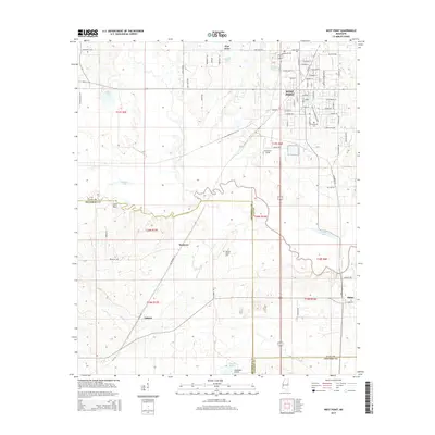
2015 Map of West Point
USGS Topo · Published 2015About this map
West Point serves as the primary urban center in this 2015 study, situated at the intersection of Clay, Lowndes, and Oktibbeha counties. The landscape is defined by the winding course of the Tibbee Creek drainage system, with Tibbee Lake and Camps Lake marking the low-lying southern sections. The map reveals a transition from the dense street grid of the city—featuring thoroughfares like Martin Luther King Dr and E Broad St—to the outlying agricultural and rural residential areas of Osborn and Muldrow.
Find a feature on this map
83 named features on this map. Tap any name to fly to it.
Don’t see what you’re looking for? This feature index may not catch every label — zoom into the map to look around manually.
Map Details
Editions of this 2015 West Point Map
This is the sole edition of this map. No revisions or reprints were ever made.
Other maps of this area

1953 · West Point
USGS Topo · 1:250,000

1958 · West Point
USGS Topo · 1:250,000

1959 · Artesia
USGS Topo · 1:62,500

1959 · West Point
USGS Topo · 1:62,500

1959 · Pheba
USGS Topo · 1:62,500

1963 · West Point
USGS Topo · 1:250,000

1965 · Starkville
USGS Topo · 1:24,000

1982 · West Point
USGS Topo · 1:100,000

1984 · West Point
USGS Topo · 1:250,000
1987 · Cedar Bluff
USGS Topo · 1:24,000