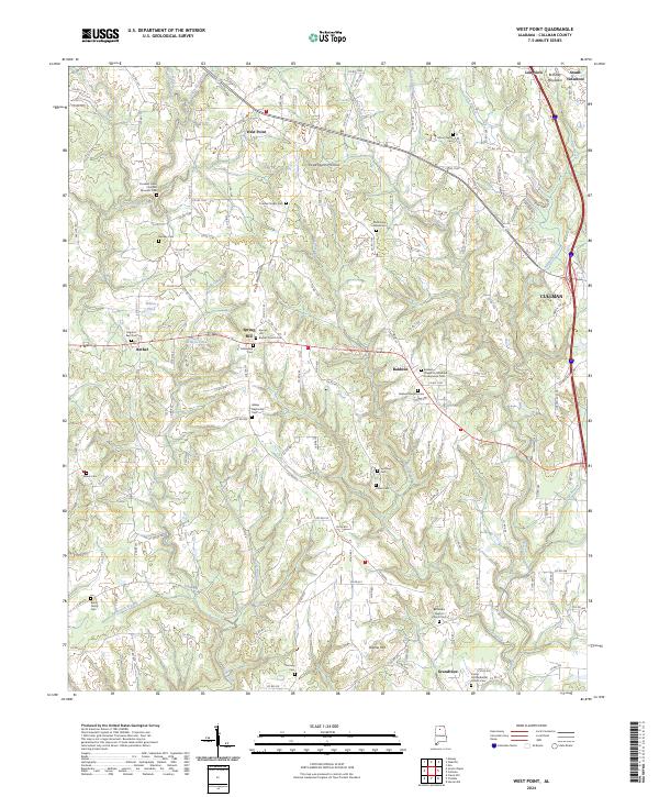
2024 Map of West Point
USGS Topo · Published 2024About this map
Brindley Mountain stands as a prominent terrain feature in this northern Alabama landscape, marking the transition between the plateau and the intricate creek valleys below. The map reveals a dense network of small rural communities and family-named landmarks, most notably the Crooked Creek Civil War Museum Cem which anchors the local historical narrative. The settlement pattern follows the high ground and the paths of waterways like Crooked Creek and Ryan Creek, with numerous country churches and cemeteries such as Bethsadia Baptist Church Cem and Spring Hill Baptist Church Cem serving as the social and genealogical heart of the area. The map also traces the outskirts of Cullman, showing the expansion of residential developments near South Vinemont and Baldwin along the ridgelines and hollows like Sweetgum Hollow.
Find a feature on this map
167 named features on this map. Tap any name to fly to it.
Don’t see what you’re looking for? This feature index may not catch every label — zoom into the map to look around manually.
Map Details
Editions of this 2024 West Point Map
This is the sole edition of this map. No revisions or reprints were ever made.
Other maps of this area

1888 · Cullman
USGS Topo · 1:125,000

1892 · Cullman
USGS Topo · 1:125,000

1927 · Falkville
USGS Topo · 1:24,000

1935 · Danville
USGS Topo · 1:48,000

1936 · Mc Kendry
USGS Topo · 1:24,000

1936 · Eva
USGS Topo · 1:24,000

1938 · Danville
USGS Topo · 1:62,500

1949 · Falkville
USGS Topo · 1:24,000
1949 · Eva
USGS Topo · 1:24,000
1951 · Eva
USGS Topo · 1:24,000