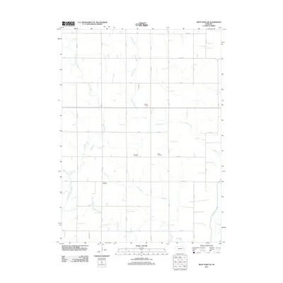
2011 Map of West Point SE
USGS Topo · Published 2011About this map
The agricultural landscape of Burt County is defined by a grid of rural roads and a network of winding waterways. Several small, family or community burial sites such as Pioneer Cemetery and Blomgren Cemetery are preserved amidst the section lines, providing vital reference points for local genealogists. The terrain is drained by numerous natural channels including Peterson Creek, Cuming Creek, and Dry Creek, which meander through the farmland independently of the strict rectangular survey lines.
Find a feature on this map
35 named features on this map. Tap any name to fly to it.
Don’t see what you’re looking for? This feature index may not catch every label — zoom into the map to look around manually.
Map Details
Editions of this 2011 West Point SE Map
This is the sole edition of this map. No revisions or reprints were ever made.
Other maps of this area

1955 · Fremont
USGS Topo · 1:250,000

1957 · Fremont
USGS Topo · 1:250,000

1958 · Fremont
USGS Topo · 1:250,000

1966 · Oakland
USGS Topo · 1:24,000

1966 · West Point NW
USGS Topo · 1:24,000

1966 · West Point SE
USGS Topo · 1:24,000

1966 · Uehling
USGS Topo · 1:24,000

1966 · Lyons
USGS Topo · 1:24,000

1966 · West Point NE
USGS Topo · 1:24,000

1966 · Scribner
USGS Topo · 1:24,000