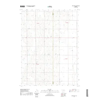
2017 Map of West Point SE
USGS Topo · Published 2017About this map
The boundary between Cuming Co and Burt Co runs vertically through this rural Nebraska landscape, defining a region where agricultural life is shaped by a complex network of waterways. Several named creeks, including Cuming Cr, Peterson Cr, and Romberg Cr, wind through the terrain, while the eastern edge is marked by the distinct channel of the Logan Creek Dredge. This system of drainage reflects the long-standing efforts to manage the fertile soils of the Elkhorn River valley for farming.
Find a feature on this map
40 named features on this map. Tap any name to fly to it.
Don’t see what you’re looking for? This feature index may not catch every label — zoom into the map to look around manually.
Map Details
Editions of this 2017 West Point SE Map
This is the sole edition of this map. No revisions or reprints were ever made.
Other maps of this area

1955 · Fremont
USGS Topo · 1:250,000

1957 · Fremont
USGS Topo · 1:250,000

1958 · Fremont
USGS Topo · 1:250,000

1966 · Oakland
USGS Topo · 1:24,000

1966 · West Point NW
USGS Topo · 1:24,000

1966 · West Point SE
USGS Topo · 1:24,000

1966 · Uehling
USGS Topo · 1:24,000

1966 · Lyons
USGS Topo · 1:24,000

1966 · West Point NE
USGS Topo · 1:24,000

1966 · Scribner
USGS Topo · 1:24,000