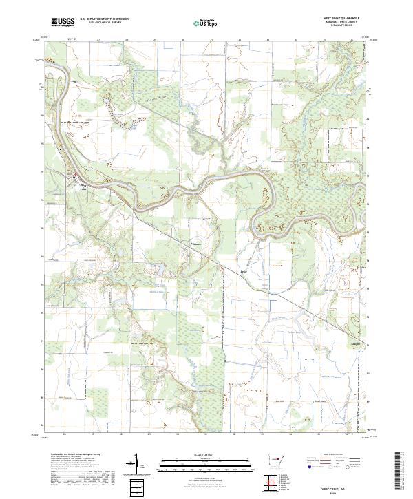
2024 Map of West Point
USGS Topo · Published 2024About this map
The Little Red River defines the landscape of this White County region, winding through a complex system of sloughs and brakes. Much of the northern and eastern terrain is preserved within the Bald Knob National Wildlife Refuge, where features like Hogpen Ridge and Crooked Slough suggest the low-lying, water-dependent character of the land. Settlement is concentrated around the town of West Point, which sits at a bend in the river near the West Point Cem.
Find a feature on this map
61 named features on this map. Tap any name to fly to it.
Don’t see what you’re looking for? This feature index may not catch every label — zoom into the map to look around manually.
Map Details
Editions of this 2024 West Point Map
This is the sole edition of this map. No revisions or reprints were ever made.
Other maps of this area

1932 · Kensett
USGS Topo · 1:62,500

1935 · Kensett
USGS Topo · 1:62,500

1935 · Augusta
USGS Topo · 1:62,500

1935 · Gregory
USGS Topo · 1:62,500

1935 · Bald Knob
USGS Topo · 1:62,500

1953 · Memphis
USGS Topo · 1:250,000

1956 · Memphis
USGS Topo · 1:250,000

1957 · Augusta
USGS Topo · 1:62,500

1957 · Gregory
USGS Topo · 1:62,500
1964 · Walker
USGS Topo · 1:24,000