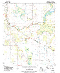
1994 Map of West Point
USGS Topo · Published 1994About this map
Little Red River meanders through this landscape, defining the character of the river valley as it was documented in the early 1990s. The settlement of West Point serves as a primary focal point, surrounded by a complex system of water management including an extensive Levee network and several drainage features like Taylor Slough and Cutoff Slough. This geography suggests a history shaped by flood control and agricultural utility, where low-lying areas like Liles Brake and Pole Brake sit alongside named elevations such as Hogpen Ridge and Bailey Lake Hill.
Find a feature on this map
35 named features on this map. Tap any name to fly to it.
Don’t see what you’re looking for? This feature index may not catch every label — zoom into the map to look around manually.
Map Details
Editions of this 1994 West Point Map
This is the sole edition of this map. No revisions or reprints were ever made.
Other maps of this area

1932 · Kensett
USGS Topo · 1:62,500

1935 · Kensett
USGS Topo · 1:62,500

1935 · Augusta
USGS Topo · 1:62,500

1935 · Gregory
USGS Topo · 1:62,500

1935 · Bald Knob
USGS Topo · 1:62,500

1953 · Memphis
USGS Topo · 1:250,000

1956 · Memphis
USGS Topo · 1:250,000

1957 · Augusta
USGS Topo · 1:62,500

1957 · Gregory
USGS Topo · 1:62,500
1964 · Walker
USGS Topo · 1:24,000