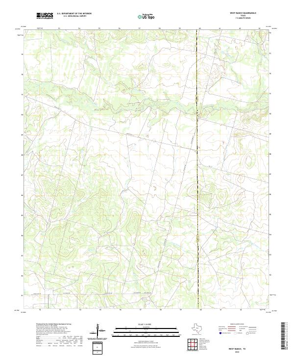
2022 Map of West Ranch
USGS Topo · Published 2022About this map
The Leona River meanders across this South Texas landscape, defining a riparian corridor through the brush country of Zavala and Frio counties. This modern topographic survey illustrates a rural environment shaped by drainage systems like Liveoak Cr and Medio Cr, which feed into the primary river valley. The map documents the local transportation network that supports the region's ranching operations, including Ranch Rd 117 and FM 117, alongside smaller routes such as Los Ninos Rd and Old Loma Vis. The county boundary between Zavala and Frio is clearly delineated, crossing several seasonal waterways including Todos Santos Cr and Yoledigo Cr. These features highlight the importance of water access and road connectivity in maintaining the agricultural and ranching heritage of this sparsely settled area.
Find a feature on this map
14 named features on this map. Tap any name to fly to it.
Don’t see what you’re looking for? This feature index may not catch every label — zoom into the map to look around manually.
Map Details
Editions of this 2022 West Ranch Map
This is the sole edition of this map. No revisions or reprints were ever made.
Other maps of this area

1939 · Big Wells
USGS Topo · 1:62,500

1942 · Divot
USGS Topo · 1:62,500

1953 · Crystal City
USGS Topo · 1:250,000

1955 · Crystal City
USGS Topo · 1:250,000

1956 · Woodward
USGS Topo · 1:62,500

1956 · Divot
USGS Topo · 1:62,500

1957 · Batesville
USGS Topo · 1:62,500

1961 · Crystal City
USGS Topo · 1:250,000

1968 · Crystal City
USGS Topo · 1:250,000
1972 · Batesville
USGS Topo · 1:24,000