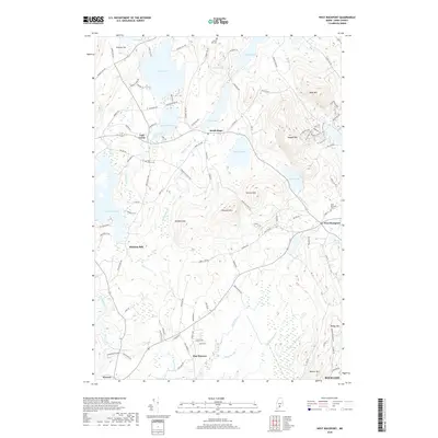
2018 Map of West Rockport
USGS Topo · Published 2018About this map
Wattons Mill and the surrounding coastal hills of Knox County are the focus of this 2018 survey. The landscape is defined by its numerous interconnected water bodies, from the expansive Alford Lake and Crawford Pond to the winding Oyster River. Small settlements such as East Union, South Hope, and West Rockport are dispersed between significant elevations like Ragged Mtn and Spruce Mtn. Genealogy researchers can find several burial grounds, including West Rockport Cem and Morey Hill Cem, documenting the area's established community centers. The northern portion of Rockland appears at the southeastern edge, where the terrain begins to slope toward the Atlantic. A network of local roads and recreational paths, such as the Jibe Trail and Tempest Trail, weave through the wooded hillsides between these historic hamlets.
Find a feature on this map
114 named features on this map. Tap any name to fly to it.
Don’t see what you’re looking for? This feature index may not catch every label — zoom into the map to look around manually.
Map Details
Editions of this 2018 West Rockport Map
This is the sole edition of this map. No revisions or reprints were ever made.
Other maps of this area

1904 · Rockland
USGS Topo · 1:62,500

1906 · Rockland
USGS Topo · 1:62,500

1913 · Waldoboro
USGS Topo · 1:48,000

1915 · Waldoboro
USGS Topo · 1:62,500

1915 · Belfast
USGS Topo · 1:62,500

1916 · Liberty
USGS Topo · 1:62,500

1917 · Belfast
USGS Topo · 1:62,500

1941 · Belfast
USGS Topo · 1:62,500

1941 · Rockland
USGS Topo · 1:62,500

1941 · Waldoboro
USGS Topo · 1:62,500