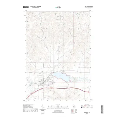
2018 Map of West Salem
USGS Topo · Published 2018About this map
West Salem serves as the focal point of this 2018 survey, situated where the La Crosse River meets the expansive Neshonoc Lake. The landscape is defined by its dramatic driftless-style topography, characterized by a series of narrow valleys locally known as coulees, such as Scotch Coulee and Larson Coulee. These geographic features dictate the rural road network, with routes like McKinley Valley Rd and Eggens Coulee Rd winding through the deep draws between high ridges like Krueger Hill. For local historians and genealogists, the map identifies several significant burial sites, including Hamilton Cem and Neshonoc Cem, which preserve the names of the region's early families. The transition from the developed streets of West Salem to the broad agricultural expanses of Pleasant Valley and Adams Valley highlights the enduring rural character of La Crosse County.
Find a feature on this map
83 named features on this map. Tap any name to fly to it.
Don’t see what you’re looking for? This feature index may not catch every label — zoom into the map to look around manually.
Map Details
Editions of this 2018 West Salem Map
This is the sole edition of this map. No revisions or reprints were ever made.
Other maps of this area

1909 · Sparta
USGS Topo · 1:62,500

1926 · North Bend
USGS Topo · 1:62,500

1927 · La Crosse
USGS Topo · 1:62,500

1928 · Melrose
USGS Topo · 1:48,000

1929 · North Bend
USGS Topo · 1:62,500

1930 · La Crosse
USGS Topo · 1:62,500

1947 · Sparta
USGS Topo · 1:62,500

1949 · Sparta
USGS Topo · 1:62,500

1949 · Melrose
USGS Topo · 1:62,500

1953 · Eau Claire
USGS Topo · 1:250,000