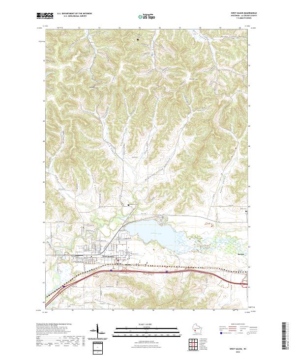
2022 Map of West Salem
USGS Topo · Published 2022About this map
Neshonoc Lake serves as a central hub for this portion of the La Crosse River valley, where the water is fed by Neshonoc Cr and Hoyer Coulee. The village of West Salem sits just south of the lake, showing a detailed street grid and significant sites like Hamilton Cem. To the east, the village of Bangor is situated near the confluence of Burns Cr and the river, marking an important corridor for regional travel.
Find a feature on this map
104 named features on this map. Tap any name to fly to it.
Don’t see what you’re looking for? This feature index may not catch every label — zoom into the map to look around manually.
Map Details
Editions of this 2022 West Salem Map
This is the sole edition of this map. No revisions or reprints were ever made.
Other maps of this area

1909 · Sparta
USGS Topo · 1:62,500

1926 · North Bend
USGS Topo · 1:62,500

1927 · La Crosse
USGS Topo · 1:62,500

1928 · Melrose
USGS Topo · 1:48,000

1929 · North Bend
USGS Topo · 1:62,500

1930 · La Crosse
USGS Topo · 1:62,500

1947 · Sparta
USGS Topo · 1:62,500

1949 · Sparta
USGS Topo · 1:62,500

1949 · Melrose
USGS Topo · 1:62,500

1953 · Eau Claire
USGS Topo · 1:250,000