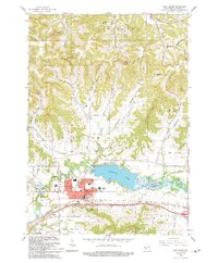
1993 Map of West Salem
USGS Topo · Published 1993About this map
Neshonoc Lake serves as the central focal point for this region of La Crosse County, created by the damming of the La Crosse River. The village of West Salem sits at the nexus of the valley's transit and social life, hosting the County Fairground and essential local institutions like the High Sch and Middle Sch. The surrounding landscape is defined by its numerous coulees—deep, narrow valleys characteristic of the Driftless Area—including Severson Coulee, Sweden Coulee, and Herman Coulee.
Find a feature on this map
77 named features on this map. Tap any name to fly to it.
Don’t see what you’re looking for? This feature index may not catch every label — zoom into the map to look around manually.
Map Details
Editions of this 1993 West Salem Map
This is the sole edition of this map. No revisions or reprints were ever made.
Other maps of this area

1909 · Sparta
USGS Topo · 1:62,500

1926 · North Bend
USGS Topo · 1:62,500

1927 · La Crosse
USGS Topo · 1:62,500

1928 · Melrose
USGS Topo · 1:48,000

1929 · North Bend
USGS Topo · 1:62,500

1930 · La Crosse
USGS Topo · 1:62,500

1947 · Sparta
USGS Topo · 1:62,500

1949 · Sparta
USGS Topo · 1:62,500

1949 · Melrose
USGS Topo · 1:62,500

1953 · Eau Claire
USGS Topo · 1:250,000