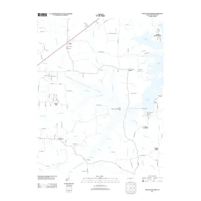
2013 Map of West Sandy Dike
USGS Topo · Published 2013About this map
The West Sandy Creek Dewatering Area defines much of this Tennessee landscape, illustrating complex mid-century hydraulic engineering designed to manage the watershed flowing into Kentucky Lake. The massive West Sand Dike stands as the primary barrier in this system, separating the managed drainage ditch network from the sprawling waters of the lake. Small rural communities like Old Springville and Elkhorn anchor the inland roads, while the shoreline has transitioned toward recreation at Antioch Harbor Resort and Pleasant View Resort. Genealogists may find value in the various family-named landmarks and water features, such as Haigler Ridge and Mays Bridge, which indicate long-standing land ownership patterns. The map detail highlights a network of drainage infrastructure, including the West Sandy Creek Drainage Ditch and Grudge Ditch, showing how the low-lying terrain near Oakland and Sunny Side was adapted for agriculture and flood control.
Find a feature on this map
109 named features on this map. Tap any name to fly to it.
Don’t see what you’re looking for? This feature index may not catch every label — zoom into the map to look around manually.
Map Details
Editions of this 2013 West Sandy Dike Map
This is the sole edition of this map. No revisions or reprints were ever made.
Other maps of this area

1936 · Poplar Creek
USGS Topo · 1:24,000

1936 · Conyersville
USGS Topo · 1:24,000

1936 · Buchanan
USGS Topo · 1:24,000

1936 · Big Sandy
USGS Topo · 1:24,000

1936 · Mansfield
USGS Topo · 1:24,000

1936 · Centerville Landing
USGS Topo · 1:24,000

1936 · Manleyville
USGS Topo · 1:24,000

1936 · Paris
USGS Topo · 1:24,000

1936 · Springville
USGS Topo · 1:24,000

1938 · Springville
USGS Topo · 1:24,000