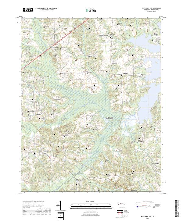
2022 Map of West Sandy Dike
USGS Topo · Published 2022About this map
Kentucky Lake dominates the eastern edge of this Henry County landscape, where the waters of the Tennessee River system define the local geography. The map reveals an intricate network of drainage and water management, notably the W Sandy Cr Drainage Ditch and the West Sandy Creek Dewatering Area, which illustrate the complex engineering required to balance the low-lying wetlands with local agriculture. Small communities like Old Springville and Oakland are connected by a web of rural roads, many bearing family names that mirror the numerous cemeteries found throughout the area, such as Old Beaverdam Cem and Mossman Hill Cem.
Find a feature on this map
147 named features on this map. Tap any name to fly to it.
Don’t see what you’re looking for? This feature index may not catch every label — zoom into the map to look around manually.
Map Details
Editions of this 2022 West Sandy Dike Map
This is the sole edition of this map. No revisions or reprints were ever made.
Other maps of this area

1936 · Poplar Creek
USGS Topo · 1:24,000

1936 · Conyersville
USGS Topo · 1:24,000

1936 · Buchanan
USGS Topo · 1:24,000

1936 · Big Sandy
USGS Topo · 1:24,000

1936 · Mansfield
USGS Topo · 1:24,000

1936 · Centerville Landing
USGS Topo · 1:24,000

1936 · Manleyville
USGS Topo · 1:24,000

1936 · Paris
USGS Topo · 1:24,000

1936 · Springville
USGS Topo · 1:24,000

1938 · Springville
USGS Topo · 1:24,000