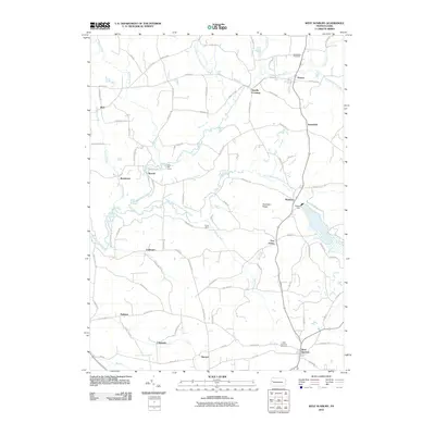
2010 Map of West Sunbury
USGS Topo · Published 2010About this map
Slippery Rock Creek and its many branches, including the North Branch and South Branch, weave through this rural landscape of northern Butler County. The region is defined by a high density of small named settlements and crossroads, ranging from Boyers and Annandale in the north to Claytonia and Sherwin in the south. The area’s historical infrastructure is evident in the presence of Annandale Cemetery and the West Sunbury Cemetery, serving the community of West Sunbury. Industrial and recreational markers are interspersed throughout the terrain, from the Glades Dam near Moniteau to seasonal locations like Rock Hill Camp and Camp Davis. This 2010 survey also documents the local road network, showing family-named routes such as Dematteis Rd and Peffer Rd that connect these persistent Pennsylvania hamlets.
Find a feature on this map
89 named features on this map. Tap any name to fly to it.
Don’t see what you’re looking for? This feature index may not catch every label — zoom into the map to look around manually.
Map Details
Editions of this 2010 West Sunbury Map
This is the sole edition of this map. No revisions or reprints were ever made.
Other maps of this area

1908 · Zelienople
USGS Topo · 1:62,500

1909 · Butler
USGS Topo · 1:62,500

1910 · Zelienople
USGS Topo · 1:62,500

1910 · Hilliards
USGS Topo · 1:62,500

1911 · Butler
USGS Topo · 1:62,500

1912 · Hilliards
USGS Topo · 1:62,500

1913 · Mercer
USGS Topo · 1:62,500

1939 · Mercer
USGS Topo · 1:62,500

1943 · Mercer
USGS Topo · 1:62,500

1944 · Hilliards
USGS Topo · 1:62,500