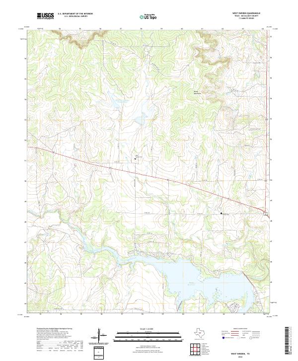
2022 Map of West Sweden
USGS Topo · Published 2022About this map
The Brady Mountains define the northern horizon of this McCulloch County landscape, where the terrain transitions from high ridges down toward the significant waters of the Brady Reservoir. This contemporary survey illustrates a rural region characterized by large ranch holdings and a complex network of private access routes like PVT RD W/LKD Gate, interspersed with established county roads. The historic presence of early Texas settlements is anchored by the West Sweden Cem and Carroll Colony Cem, which serve as vital markers for genealogical research in this part of the Edwards Plateau. Water management is a central theme of the geography, evidenced by Reservoir Number Fortythree A and the winding course of Brady Creek. The map details the local road infrastructure near the reservoir, including South Loop and N Shore Dr, which support the recreational and residential areas along the shoreline.
Find a feature on this map
37 named features on this map. Tap any name to fly to it.
Don’t see what you’re looking for? This feature index may not catch every label — zoom into the map to look around manually.
Map Details
Editions of this 2022 West Sweden Map
This is the sole edition of this map. No revisions or reprints were ever made.
Other maps of this area

1892 · Eden
USGS Topo · 1:125,000

1894 · Brady
USGS Topo · 1:125,000

1896 · Eden
USGS Topo · 1:125,000

1928 · Waldrip
USGS Topo · 1:62,500

1931 · Stacy
USGS Topo · 1:62,500

1954 · Brownwood
USGS Topo · 1:250,000

1960 · West Sweden
USGS Topo · 1:24,000

1960 · Melvin
USGS Topo · 1:24,000

1960 · Brady North
USGS Topo · 1:24,000

1963 · Brady SW
USGS Topo · 1:24,000