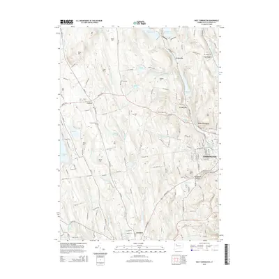
2015 Map of West Torrington
USGS Topo · Published 2015About this map
Torrington and its surrounding hill country are defined by the convergence of the West Branch Naugatuck River and several distinct brook systems. The landscape transitions from the industrial character of the city to the elevated terrain of Ivy Mtn and Brass Mtn to the northwest. This 2015 data illustrates a complex network of water management, featuring the Hatchaloosie Reservoir, Stillwater Pond, and the Hall Meadow Brook Reservoir. Genealogists will find a wealth of burial sites across the township, from the centrally located West Torrington Cem to the Old Middle Street Cem and the Collins Cem. Small historic hubs like Drakeville and Wrightville remain clearly marked along the river valleys, while the southwestern portion of the map captures the northern outskirts of Litchfield and the shores of Woodbridge Lake.
Find a feature on this map
164 named features on this map. Tap any name to fly to it.
Don’t see what you’re looking for? This feature index may not catch every label — zoom into the map to look around manually.
Map Details
Editions of this 2015 West Torrington Map
This is the sole edition of this map. No revisions or reprints were ever made.
Other maps of this area

1892 · Winsted
USGS Topo · 1:62,500

1892 · Cornwall
USGS Topo · 1:62,500

1892 · New Milford
USGS Topo · 1:62,500

1893 · Waterbury
USGS Topo · 1:62,500

1893 · New Milford
USGS Topo · 1:62,500

1893 · Cornwall
USGS Topo · 1:62,500

1903 · Cornwall
USGS Topo · 1:62,500

1904 · New Milford
USGS Topo · 1:62,500

1904 · Waterbury
USGS Topo · 1:62,500

1904 · Litchfield
USGS Topo · 1:125,000