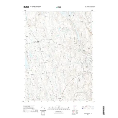
2021 Map of West Torrington
USGS Topo · Published 2021About this map
Goshen and West Torrington anchor this Litchfield County landscape, where the headwaters of the Naugatuck and Bantam rivers carve through the upland terrain. The map documents a complex water management system essential to the region's development, featuring the Reuben Hart Reservoir, Hatchaloosie Reservoir, and Litchfield Reservoir. Genealogists will find a high density of burial sites preserved here, from the Goshen Center Cem near the town center to the Old Middle Street Cem and the more remote Collins Cem. The physical geography is defined by prominent rises like Ivy Mtn and Beech Hill, which overlook various swamp lands including Peat Swamp and Bantam Peat Swamp. Industrial history is whispered through names like Nickel Mine Brook, while residential growth is captured at Newberry Corner and Drakeville, showing the modern expansion of these historic New England settlements along the Sharon Tpke and Torrington Rd.
Find a feature on this map
158 named features on this map. Tap any name to fly to it.
Don’t see what you’re looking for? This feature index may not catch every label — zoom into the map to look around manually.
Map Details
Editions of this 2021 West Torrington Map
This is the sole edition of this map. No revisions or reprints were ever made.
Other maps of this area

1892 · Winsted
USGS Topo · 1:62,500

1892 · Cornwall
USGS Topo · 1:62,500

1892 · New Milford
USGS Topo · 1:62,500

1893 · Waterbury
USGS Topo · 1:62,500

1893 · New Milford
USGS Topo · 1:62,500

1893 · Cornwall
USGS Topo · 1:62,500

1903 · Cornwall
USGS Topo · 1:62,500

1904 · New Milford
USGS Topo · 1:62,500

1904 · Waterbury
USGS Topo · 1:62,500

1904 · Litchfield
USGS Topo · 1:125,000