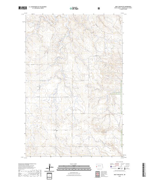
2024 Map of West Twin Butte
USGS Topo · Published 2024About this map
Plain View Cem serves as a lone landmark for local history in this section of Golden Valley County, situated just off Co Rd 11. The landscape is defined by the drainage basins of Elk Creek, including its East Branch, and Wannagan Creek, which carve through the high prairie. This 2024 survey illustrates the vast extent of the Little Missouri National Grassland in western North Dakota, where the section lines of the Public Land Survey System dictate the modern road network. The prominent West Twin Butte rises in the southeastern portion of the quadrangle, connected to the wider region by Twin Butte Rd. This map shows a territory where the rural grid remains largely untouched by dense development, preserving the original agricultural and grazing layout established by the early townships.
Find a feature on this map
24 named features on this map. Tap any name to fly to it.
Don’t see what you’re looking for? This feature index may not catch every label — zoom into the map to look around manually.
Map Details
Editions of this 2024 West Twin Butte Map
This is the sole edition of this map. No revisions or reprints were ever made.
Other maps of this area

1953 · Dickinson
USGS Topo · 1:250,000

1953 · Watford City
USGS Topo · 1:250,000

1957 · Dickinson
USGS Topo · 1:250,000

1957 · Watford City
USGS Topo · 1:250,000

1967 · Watford City
USGS Topo · 1:250,000

1974 · Hootowl Creek West
USGS Topo · 1:24,000

1974 · West Twin Butte
USGS Topo · 1:24,000

1974 · Roosevelt Creek West
USGS Topo · 1:24,000
1974 · Hootowl Creek SW
USGS Topo · 1:24,000

1974 · Wannagan Creek West
USGS Topo · 1:24,000