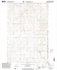
1997 Map of West Twin Butte
USGS Topo · Published 2001About this map
West Twin Butte rises over the high plains of Golden Valley County, marking a landscape defined by the drainage systems of Elk Creek and Wannagan Creek. This late 20th-century revision captures a rural corner of North Dakota where small-scale markers of pioneer settlement remain visible on the land. The Little Missouri National Grassland encompasses much of the eastern portion of the map, where the terrain is etched by the East Branch Wannagan Creek and the Sixteenth Guide Meridian West.
Find a feature on this map
13 named features on this map. Tap any name to fly to it.
Don’t see what you’re looking for? This feature index may not catch every label — zoom into the map to look around manually.
Map Details
Editions of this 1997 West Twin Butte Map
This is the sole edition of this map. No revisions or reprints were ever made.
Other maps of this area

1953 · Dickinson
USGS Topo · 1:250,000

1953 · Watford City
USGS Topo · 1:250,000

1957 · Dickinson
USGS Topo · 1:250,000

1957 · Watford City
USGS Topo · 1:250,000

1967 · Watford City
USGS Topo · 1:250,000

1974 · Hootowl Creek West
USGS Topo · 1:24,000

1974 · West Twin Butte
USGS Topo · 1:24,000

1974 · Roosevelt Creek West
USGS Topo · 1:24,000
1974 · Hootowl Creek SW
USGS Topo · 1:24,000

1974 · Wannagan Creek West
USGS Topo · 1:24,000