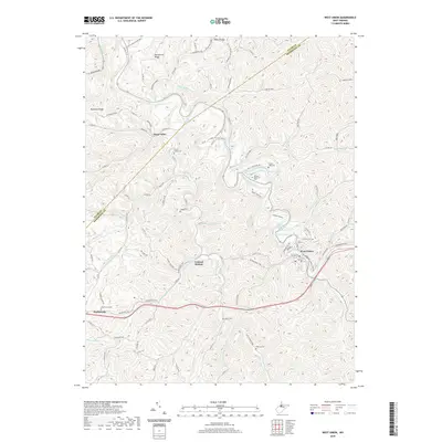
2019 Map of West Union
USGS Topo · Published 2019About this map
West Union serves as the focal point of this terrain along Middle Island Creek, where the local landscape is defined by the winding course of the creek and the path of the N Bend Rail-Trail. The area's history is preserved through numerous family and community burial grounds, such as Arnold Creek Cem, Piggott Cem, and Freeman Cem, which dot the hillsides near the small settlements of Duckworth and Central Station. The presence of the Masonic Memorial Park and the uniquely named Hunter Stansberry Spring adds a layer of local heritage to the region. To the north and west, the map follows the ridges and runs of the Appalachian plateau, including Haymond Ridge and Duckworth Ridge, providing a detailed look at the drainage networks of Arnold Creek and Nutter Fork as they feed into the larger creek system.
Find a feature on this map
102 named features on this map. Tap any name to fly to it.
Don’t see what you’re looking for? This feature index may not catch every label — zoom into the map to look around manually.
Map Details
Editions of this 2019 West Union Map
This is the sole edition of this map. No revisions or reprints were ever made.
Other maps of this area

1904 · Vadis
USGS Topo · 1:62,500

1905 · Centerpoint
USGS Topo · 1:62,500

1905 · West Union
USGS Topo · 1:62,500

1906 · Holbrook
USGS Topo · 1:62,500

1924 · Centerpoint
USGS Topo · 1:62,500

1924 · West Union
USGS Topo · 1:62,500

1924 · Holbrook
USGS Topo · 1:62,500

1925 · Centerpoint
USGS Topo · 1:62,500

1925 · Vadis
USGS Topo · 1:62,500

1926 · Holbrook
USGS Topo · 1:62,500