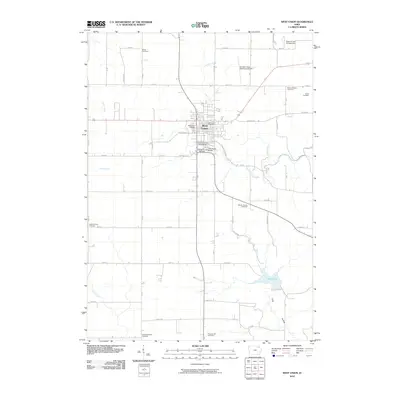
2010 Map of West Union
USGS Topo · Published 2010About this map
West Union serves as the focal point of this Fayette County survey, exhibiting a well-defined grid that radiates from the West Union Post Office and the surrounding civic infrastructure. The town's community heritage is visible through sites like the Fayette County Fairgrounds and the Fayette County Raceway, while the Vine Street Bridge provides a key crossing point. The surrounding countryside is remarkably dense with burial grounds, including the Boale Cemetery, West Union Cemetery, and Mount Pleasant Cemetery, offering significant geographic markers for genealogical research.
Find a feature on this map
37 named features on this map. Tap any name to fly to it.
Don’t see what you’re looking for? This feature index may not catch every label — zoom into the map to look around manually.
Map Details
Editions of this 2010 West Union Map
This is the sole edition of this map. No revisions or reprints were ever made.
Other maps of this area

1901 · Oelwein
USGS Topo · 1:125,000

1906 · Decorah
USGS Topo · 1:125,000

1958 · La Crosse
USGS Topo · 1:250,000

1959 · Dubuque
USGS Topo · 1:250,000

1961 · Dubuque
USGS Topo · 1:250,000

1961 · La Crosse
USGS Topo · 1:250,000

1962 · Dubuque
USGS Topo · 1:250,000

1965 · La Crosse
USGS Topo · 1:250,000

1965 · Elgin
USGS Topo · 1:24,000

1965 · Wadena
USGS Topo · 1:24,000