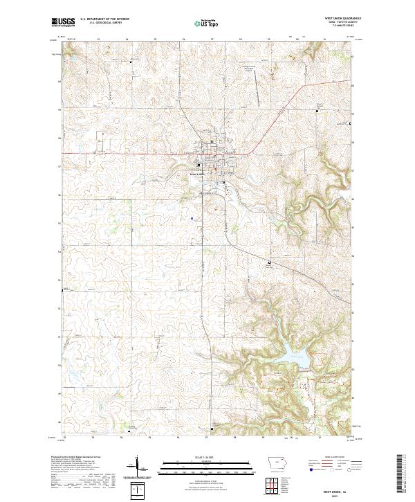
2022 Map of West Union
USGS Topo · Published 2022About this map
The Fayette County Courthouse serves as the central landmark for the city of West Union, Iowa, where a grid of streets like W Bradford St and W Jefferson St transitions into the surrounding rural section lines. The topography is defined by the dissection of the landscape by Glover Cr and Otter Cr, creating a pattern of rolling divides typical of the area's geology. To the north, the George L Scott Municipal Airport occupies a level plateau above the drainage of Falling Springs.
Find a feature on this map
56 named features on this map. Tap any name to fly to it.
Don’t see what you’re looking for? This feature index may not catch every label — zoom into the map to look around manually.
Map Details
Editions of this 2022 West Union Map
This is the sole edition of this map. No revisions or reprints were ever made.
Other maps of this area

1901 · Oelwein
USGS Topo · 1:125,000

1906 · Decorah
USGS Topo · 1:125,000

1958 · La Crosse
USGS Topo · 1:250,000

1959 · Dubuque
USGS Topo · 1:250,000

1961 · Dubuque
USGS Topo · 1:250,000

1961 · La Crosse
USGS Topo · 1:250,000

1962 · Dubuque
USGS Topo · 1:250,000

1965 · La Crosse
USGS Topo · 1:250,000

1965 · Elgin
USGS Topo · 1:24,000

1965 · Wadena
USGS Topo · 1:24,000