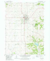
1981 Map of West Union
USGS Topo · Published 1982About this map
The county seat of West Union serves as the focal point for this survey, showcasing a community defined by its civic institutions and recreational landscapes in the early 1980s. The town's grid is bounded by notable landmarks like the Fairground, Scott Field Municipal Airport, and the West Union Country Club. This map provides significant genealogical value through its documentation of numerous burial grounds, including Mt Calvary Cem, Boale Cem, and Mt Pleasant Cem, scattered across the rolling farm country of Fayette County.
Find a feature on this map
39 named features on this map. Tap any name to fly to it.
Don’t see what you’re looking for? This feature index may not catch every label — zoom into the map to look around manually.
Map Details
Editions of this 1981 West Union Map
This is the sole edition of this map. No revisions or reprints were ever made.
Other maps of this area

1901 · Oelwein
USGS Topo · 1:125,000

1906 · Decorah
USGS Topo · 1:125,000

1958 · La Crosse
USGS Topo · 1:250,000

1959 · Dubuque
USGS Topo · 1:250,000

1961 · Dubuque
USGS Topo · 1:250,000

1961 · La Crosse
USGS Topo · 1:250,000

1962 · Dubuque
USGS Topo · 1:250,000

1965 · La Crosse
USGS Topo · 1:250,000

1965 · Elgin
USGS Topo · 1:24,000

1965 · Wadena
USGS Topo · 1:24,000