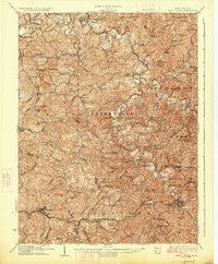
1926 Map of West Union
USGS Topo · Published 1926About this map
Middle Island Creek winds through this rugged portion of northern West Virginia, where the 1920s landscape is defined by the sharp relief of ridges like Raymond Ridge and the unique oxbow known as The Jug. The map documents a densely settled rural economy anchored by the Baltimore and Ohio railroad corridor in the south, connecting towns like Pennsboro, Tollgate, and West Union.
Find a feature on this map
125 named features on this map. Tap any name to fly to it.
Don’t see what you’re looking for? This feature index may not catch every label — zoom into the map to look around manually.
Map Details
Editions of this 1926 West Union Map
3 editions found
Other maps of this area

1903 · Littleton
USGS Topo · 1:62,500

1904 · Vadis
USGS Topo · 1:62,500

1905 · Centerpoint
USGS Topo · 1:62,500

1905 · West Union
USGS Topo · 1:62,500

1905 · Littleton
USGS Topo · 1:62,500

1905 · New Matamoras
USGS Topo · 1:62,500

1906 · Saint Marys
USGS Topo · 1:62,500

1906 · Holbrook
USGS Topo · 1:62,500

1906 · New Martinsville
USGS Topo · 1:62,500

1907 · Harrisville
USGS Topo · 1:62,500