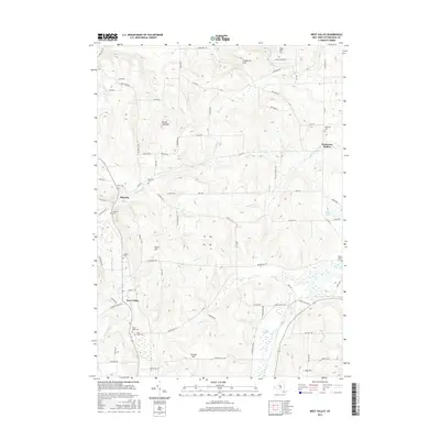
2016 Map of West Valley
USGS Topo · Published 2016About this map
West Valley and the surrounding high ground of Cattaraugus County are defined by a complex network of creeks and prominent hills. The terrain is deeply incised by Ischua Cr and Buttermilk Cr, which drain the uplands near Blue Hill and Bread Loaf Hill. In the northern section, the dramatic landform of Gunbarrel Gulf cuts through the landscape near the border of the quadrangle.
Find a feature on this map
87 named features on this map. Tap any name to fly to it.
Don’t see what you’re looking for? This feature index may not catch every label — zoom into the map to look around manually.
Map Details
Editions of this 2016 West Valley Map
This is the sole edition of this map. No revisions or reprints were ever made.
Other maps of this area

1923 · Arcade
USGS Topo · 1:62,500

1924 · Ellicottville
USGS Topo · 1:62,500

1924 · Franklinville
USGS Topo · 1:62,500

1925 · Springville
USGS Topo · 1:62,500

1925 · Arcade
USGS Topo · 1:62,500

1941 · Ellicottville
USGS Topo · 1:62,500

1942 · Franklinville
USGS Topo · 1:62,500
1954 · Springville
USGS Topo · 1:24,000

1957 · Sardinia
USGS Topo · 1:24,000

1960 · Buffalo
USGS Topo · 1:250,000