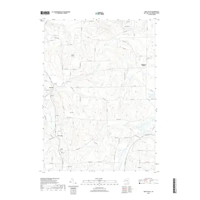
2019 Map of West Valley
USGS Topo · Published 2019About this map
West Valley and the smaller settlement of Riceville anchor this Cattaraugus County landscape, defined by a network of creeks and prominent summits. The terrain is marked by significant elevations like Bread Loaf Hill and Blue Hill, with drainage provided by the winding courses of Gooseneck Cr and Indian Cr. For those researching local history, the map provides a high density of burial sites, including the Riceville Cem, Holland Cem, and Saint Johns Cem, which are scattered throughout the valleys and along the rural roads. The eastern portion of the sheet is dominated by McKinstry Hollow and the marshy expanses of Bird Swamp near Ischua Cr. This survey illustrates the modern persistence of historic settlement patterns, where farmsteads and cemeteries remain tied to the narrow stretches of flat land between the hills.
Find a feature on this map
84 named features on this map. Tap any name to fly to it.
Don’t see what you’re looking for? This feature index may not catch every label — zoom into the map to look around manually.
Map Details
Editions of this 2019 West Valley Map
This is the sole edition of this map. No revisions or reprints were ever made.
Other maps of this area

1923 · Arcade
USGS Topo · 1:62,500

1924 · Ellicottville
USGS Topo · 1:62,500

1924 · Franklinville
USGS Topo · 1:62,500

1925 · Springville
USGS Topo · 1:62,500

1925 · Arcade
USGS Topo · 1:62,500

1941 · Ellicottville
USGS Topo · 1:62,500

1942 · Franklinville
USGS Topo · 1:62,500
1954 · Springville
USGS Topo · 1:24,000

1957 · Sardinia
USGS Topo · 1:24,000

1960 · Buffalo
USGS Topo · 1:250,000