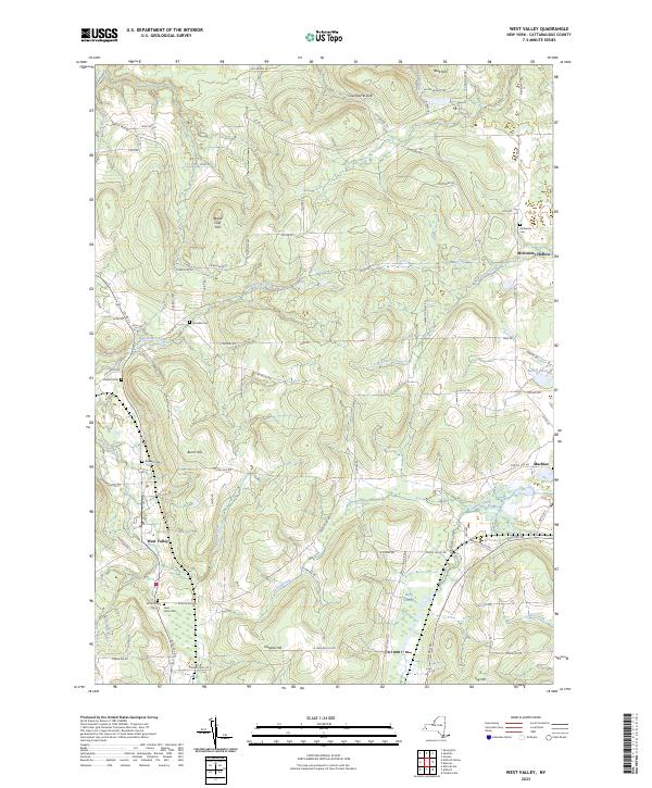
2023 Map of West Valley
USGS Topo · Published 2023About this map
West Valley sits in a high valley carved by Buttermilk Creek, serving as a central point for a landscape defined by significant elevation changes and rural cemeteries. The area's genealogical history is well-preserved across numerous family and community burial grounds, including Mount Hope Cem, Saint Johns Cem, and Holland Cem. To the east, the settlement of Machias marks the edge of a plateau that drops into Bird Swamp and the headwaters of Ischua Creek.
Find a feature on this map
78 named features on this map. Tap any name to fly to it.
Don’t see what you’re looking for? This feature index may not catch every label — zoom into the map to look around manually.
Map Details
Editions of this 2023 West Valley Map
This is the sole edition of this map. No revisions or reprints were ever made.
Other maps of this area

1923 · Arcade
USGS Topo · 1:62,500

1924 · Ellicottville
USGS Topo · 1:62,500

1924 · Franklinville
USGS Topo · 1:62,500

1925 · Springville
USGS Topo · 1:62,500

1925 · Arcade
USGS Topo · 1:62,500

1941 · Ellicottville
USGS Topo · 1:62,500

1942 · Franklinville
USGS Topo · 1:62,500
1954 · Springville
USGS Topo · 1:24,000

1957 · Sardinia
USGS Topo · 1:24,000

1960 · Buffalo
USGS Topo · 1:250,000