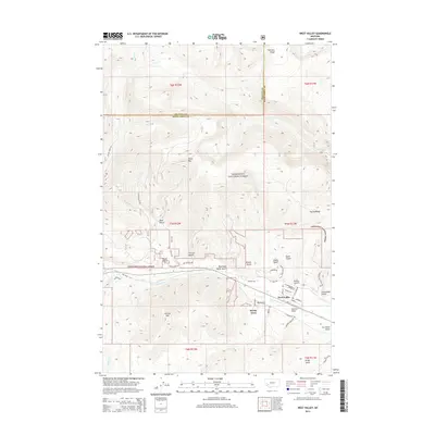
2014 Map of West Valley
USGS Topo · Published 2014About this map
Deerlodge National Forest dominates this mountain landscape, where deep gulches and high ridges define the topography of Deer Lodge County. The settlement of West Valley serves as a local hub near the southern base of Stucky Ridge, connected by a network of local roads such as N Cable Rd and Rumsey St. To the west, Stump Town sits tucked away near Big Gulch, illustrating the small-scale residential pockets that formed around the area's natural resource extraction and ranching history. The terrain is marked by colorfully named drainages like Blue Eyed Nellie Gulch, Tin Can Gulch, and Ice House Gulch, all carved into the slopes of peaks like Garrity Mtn and Olson Mtn. Warm Springs Cr and Lost Cr provide the primary drainage for these steep valleys, while landmarks like Hatcher Field and Thornton Ridge offer specific points of orientation for researchers tracing land use and local development.
Find a feature on this map
49 named features on this map. Tap any name to fly to it.
Don’t see what you’re looking for? This feature index may not catch every label — zoom into the map to look around manually.
Map Details
Editions of this 2014 West Valley Map
This is the sole edition of this map. No revisions or reprints were ever made.
Other maps of this area

1889 · Helena
USGS Topo · 1:250,000

1893 · Helena
USGS Topo · 1:250,000

1899 · Helena
USGS Topo · 1:250,000

1903 · Helena
USGS Topo · 1:250,000

1908 · Philipsburg
USGS Topo · 1:125,000

1947 · Butte
USGS Topo · 1:250,000

1958 · Butte
USGS Topo · 1:250,000

1960 · Butte
USGS Topo · 1:250,000

1961 · Anaconda
USGS Topo · 1:62,500

1962 · Butte
USGS Topo · 1:250,000