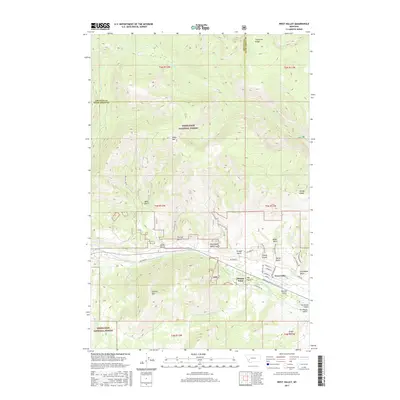
2017 Map of West Valley
USGS Topo · Published 2017About this map
West Valley and the small settlement of Stump Town occupy the lower elevations where the steep terrain of the Deerlodge National Forest meets the valley floor. This 2017 study captures a landscape defined by its network of drainages and historical mining paths, including Blue Eyed Nellie Gulch, Geary Gulch, and Stucky Gulch. The residential grid of West Valley is tightly clustered around streets like Rumsey St and Powell St, while Stumptown Rd connects the outlying cluster to the south.
Find a feature on this map
50 named features on this map. Tap any name to fly to it.
Don’t see what you’re looking for? This feature index may not catch every label — zoom into the map to look around manually.
Map Details
Editions of this 2017 West Valley Map
This is the sole edition of this map. No revisions or reprints were ever made.
Other maps of this area

1889 · Helena
USGS Topo · 1:250,000

1893 · Helena
USGS Topo · 1:250,000

1899 · Helena
USGS Topo · 1:250,000

1903 · Helena
USGS Topo · 1:250,000

1908 · Philipsburg
USGS Topo · 1:125,000

1947 · Butte
USGS Topo · 1:250,000

1958 · Butte
USGS Topo · 1:250,000

1960 · Butte
USGS Topo · 1:250,000

1961 · Anaconda
USGS Topo · 1:62,500

1962 · Butte
USGS Topo · 1:250,000