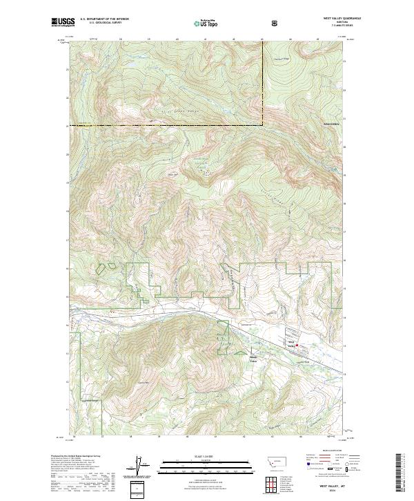
2024 Map of West Valley
USGS Topo · Published 2024About this map
West Valley and the nearby cluster of Stump Town occupy the eastern base of the Flint Creek Range, where the steep mountain slopes give way to the drainage of Warm Springs Creek. The landscape is defined by its deep gulches and high ridges, including the prominent Thornton Ridge and Stucky Ridge, which overlook the complex network of forest roads and residential streets. This modern topographic view shows the clear transition from the managed timberlands of the Deerlodge National Forest to the expanding street grid near Anaconda.
Find a feature on this map
54 named features on this map. Tap any name to fly to it.
Don’t see what you’re looking for? This feature index may not catch every label — zoom into the map to look around manually.
Map Details
Editions of this 2024 West Valley Map
This is the sole edition of this map. No revisions or reprints were ever made.
Other maps of this area

1889 · Helena
USGS Topo · 1:250,000

1893 · Helena
USGS Topo · 1:250,000

1899 · Helena
USGS Topo · 1:250,000

1903 · Helena
USGS Topo · 1:250,000

1908 · Philipsburg
USGS Topo · 1:125,000

1947 · Butte
USGS Topo · 1:250,000

1958 · Butte
USGS Topo · 1:250,000

1960 · Butte
USGS Topo · 1:250,000

1961 · Anaconda
USGS Topo · 1:62,500

1962 · Butte
USGS Topo · 1:250,000